Skip to content
← All projects

NYC · Urban Land Use

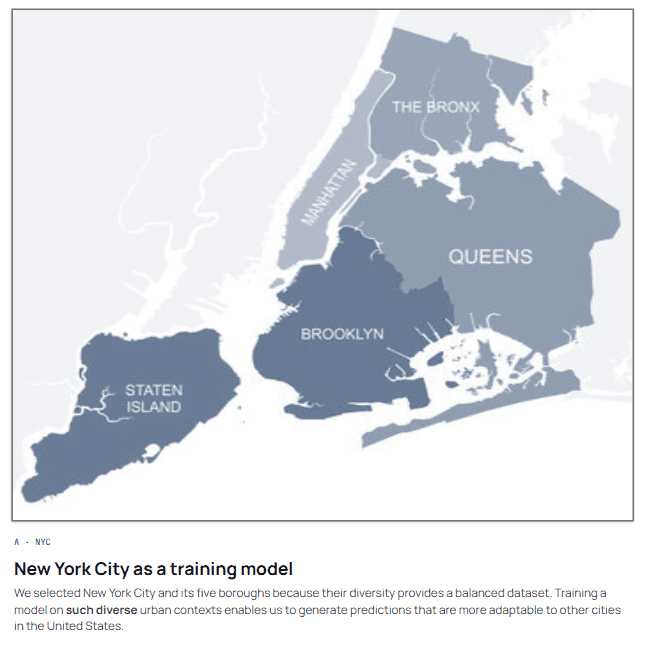
Land use is recorded, but slowly and unevenly. This project asks whether built-form morphology, environmental data and proximity to city features carry enough signal to predict it, and how much data a model needs before it starts being right.

Context

IAAC · Barcelona

Year

2026

Stack

Machine learning · Python · GIS · Urban data

NYC · Urban Land Use

Brief

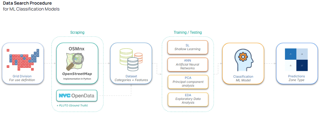
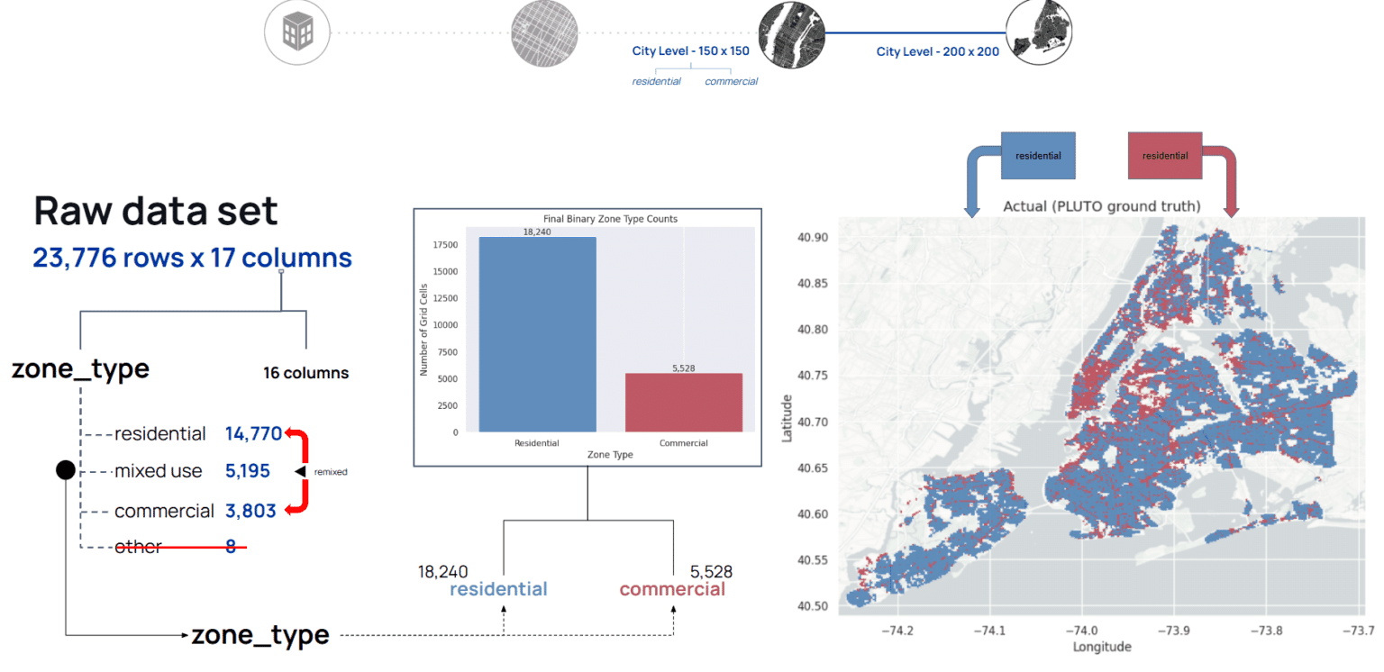
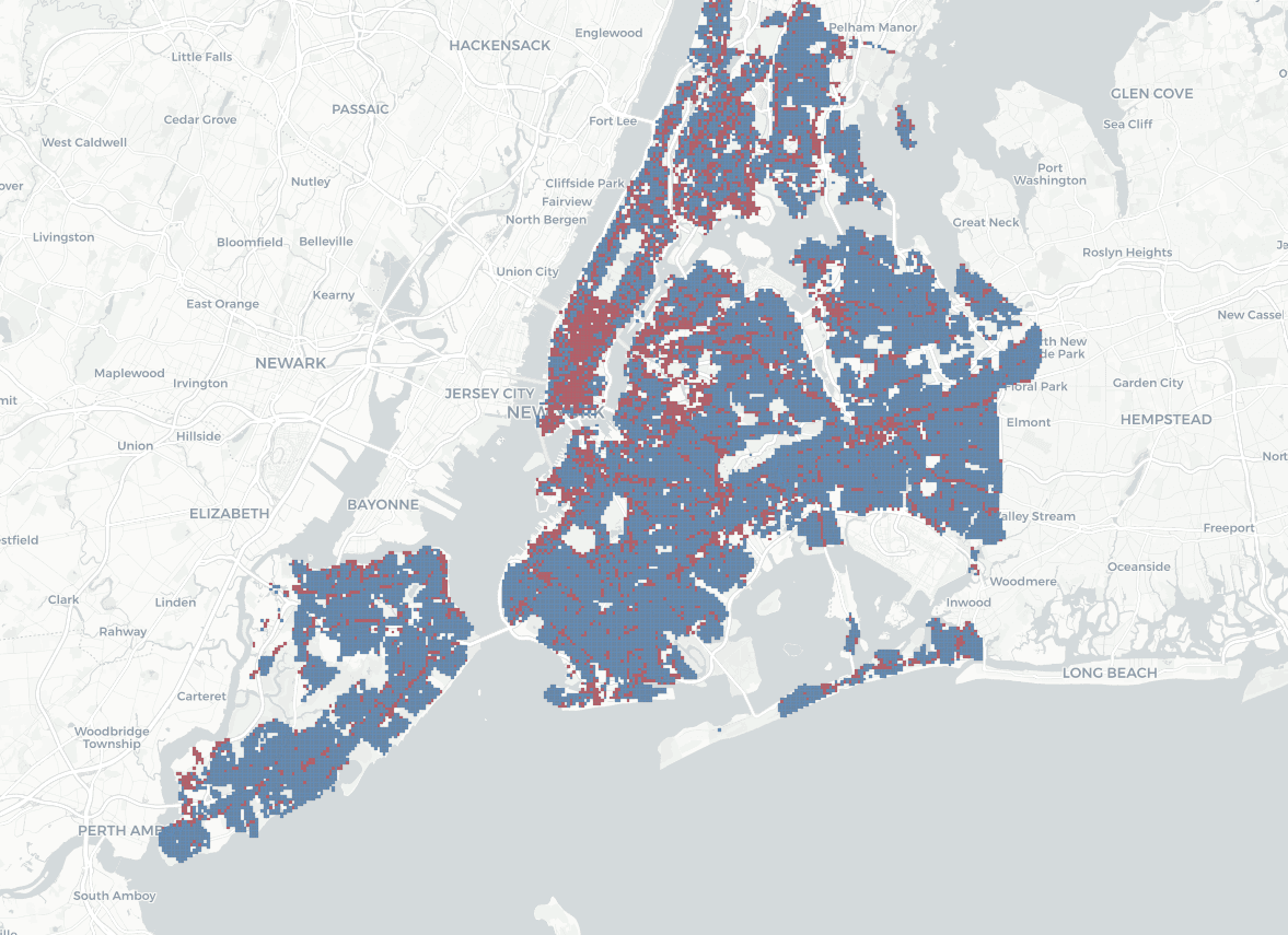
NYC – Urban Land Use investigates whether machine learning can classify urban areas as commercial or residential using built-form morphology, environmental data, and proximity to surrounding city features. The project reframes land-use prediction as a spatial grid-classification problem, combining expanded urban datasets to identify the conditions required for accurate prediction at the city scale.

“Can we predict the land use of a space based on existing environmental information from official and unofficial sources?”

What’s the sweet spot for a Machine Learning model to start predicting accurately at an urban level?
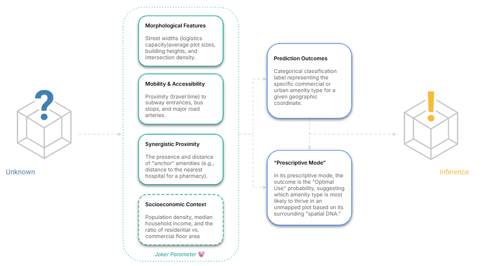
01 · Question

Predicting land use from what a place looks like

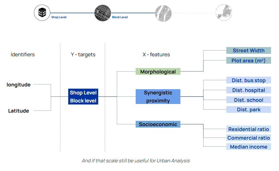
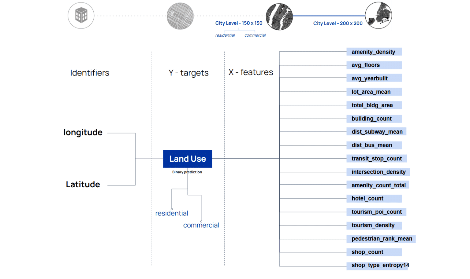
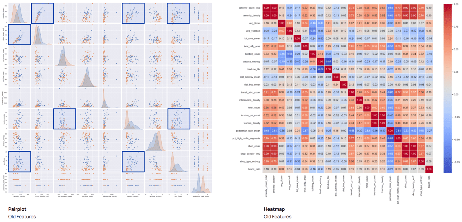
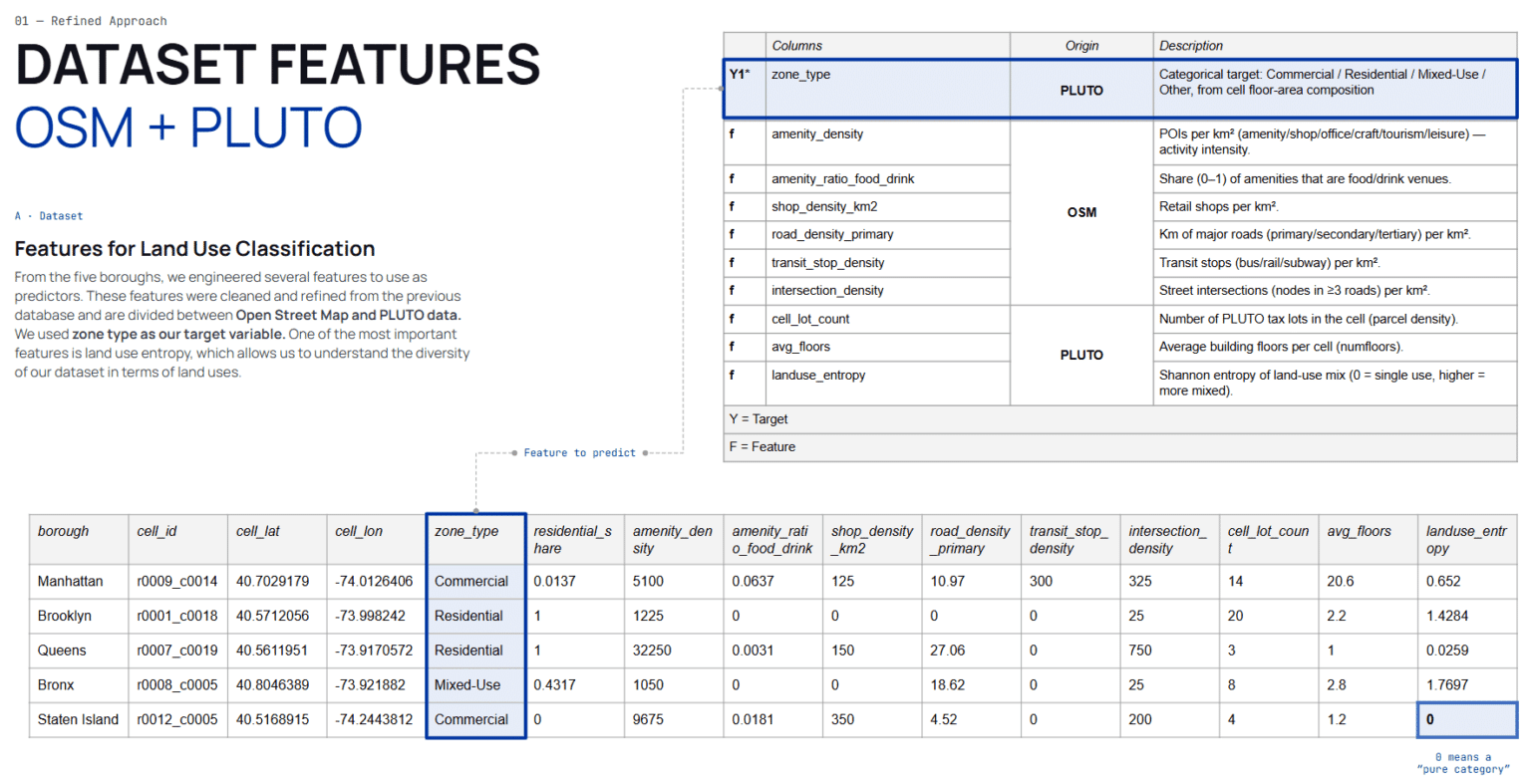
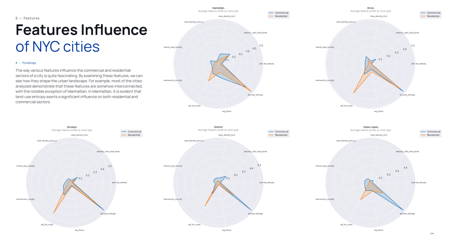
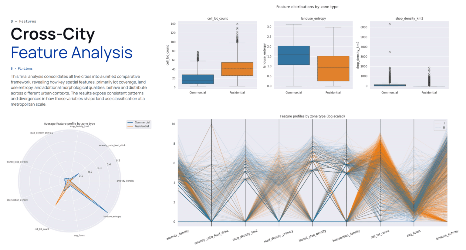
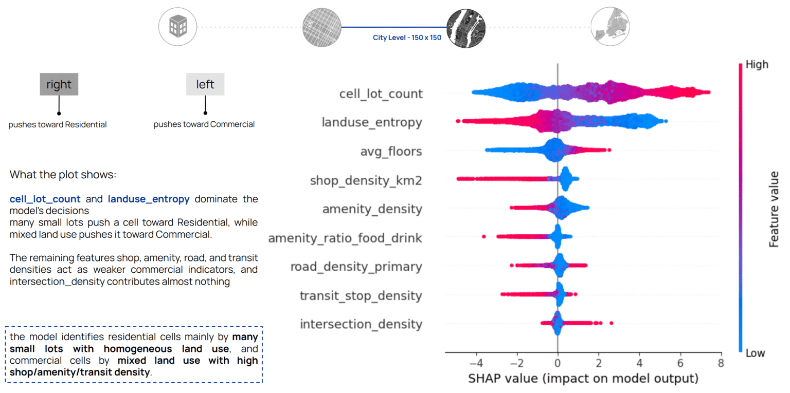
The question is whether official and unofficial environmental information is enough to say what a space is used for. Built-form morphology, environmental readings and proximity to surrounding city features are the only inputs; the label is what has to be inferred.

NYC · Urban Land Use — 1
NYC · Urban Land Use — 2
NYC · Urban Land Use — 3
NYC · Urban Land Use — 4
NYC · Urban Land Use — 5
NYC · Urban Land Use — 6
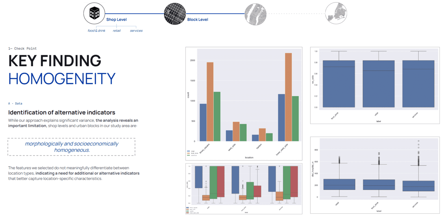
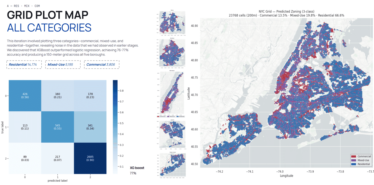
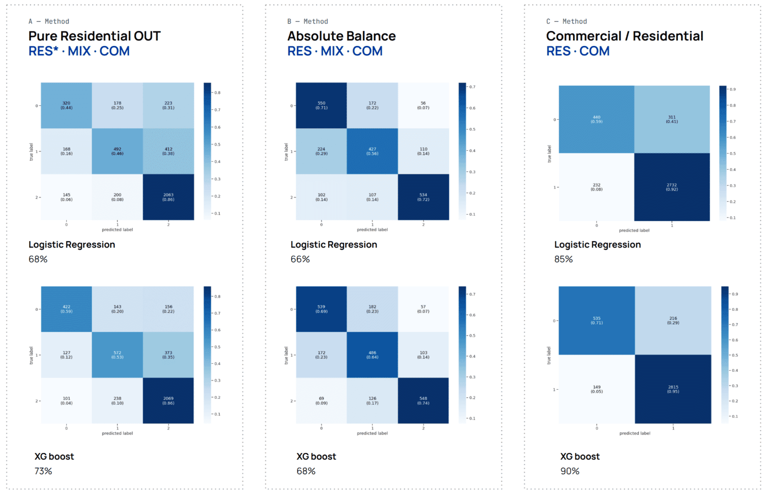
We shifted strategy, from predicting shop types to classifying land use across a spatial grid with expanded features.

02 · Method

Land use as a grid-classification problem

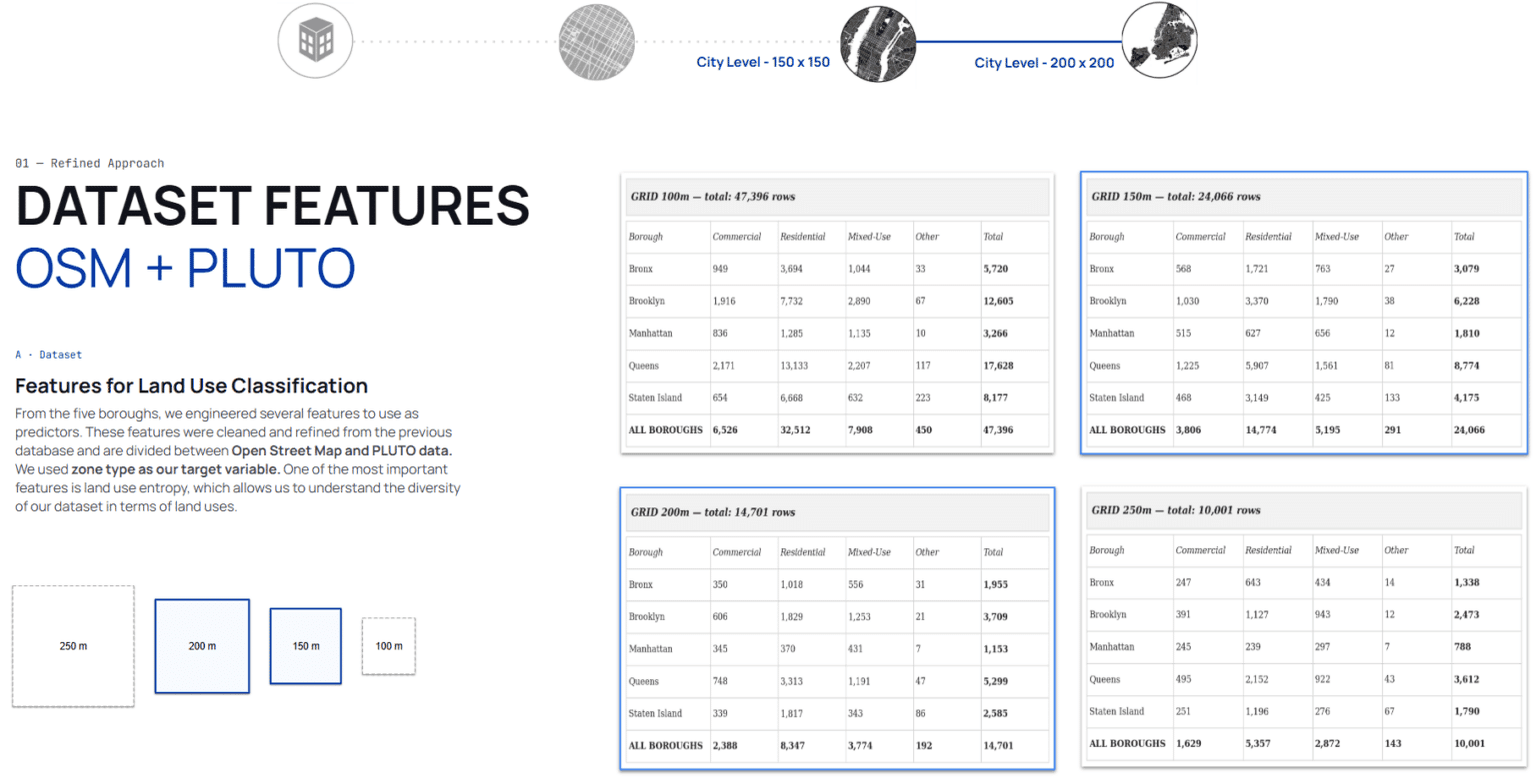
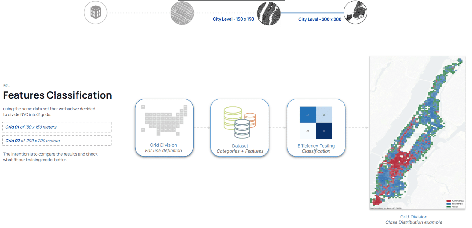
Reframing the city as a spatial grid turns an ambiguous urban question into a classification task with a clear unit of analysis. Expanded urban datasets are joined onto that grid, so every cell carries the same feature vocabulary.

NYC · Urban Land Use — 7
NYC · Urban Land Use — 8
NYC · Urban Land Use — 9
NYC · Urban Land Use — 10
NYC · Urban Land Use — 11
NYC · Urban Land Use — 12
NYC · Urban Land Use — 13

03 · Findings

Where the model starts being right

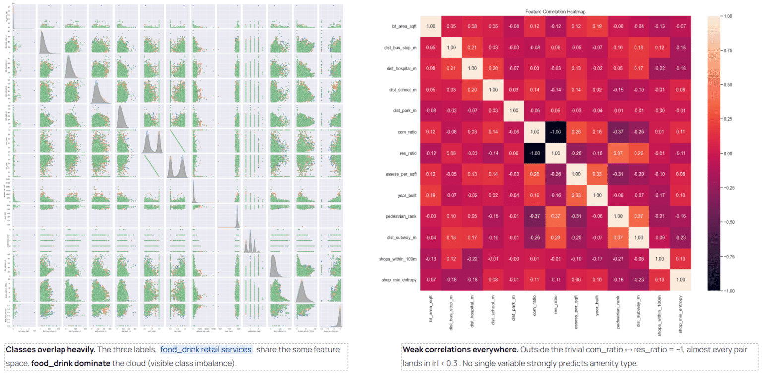
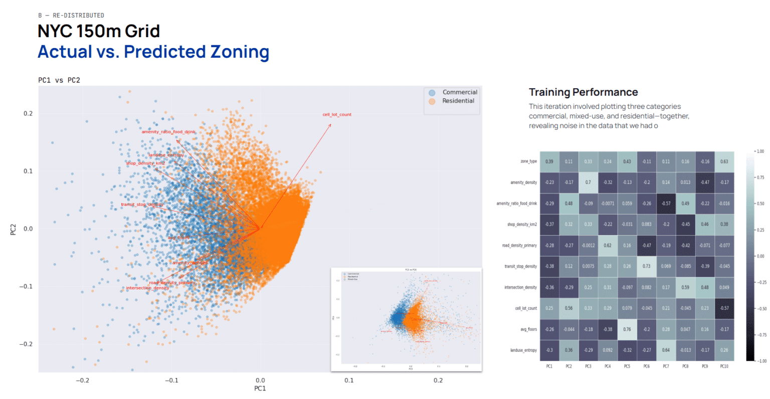
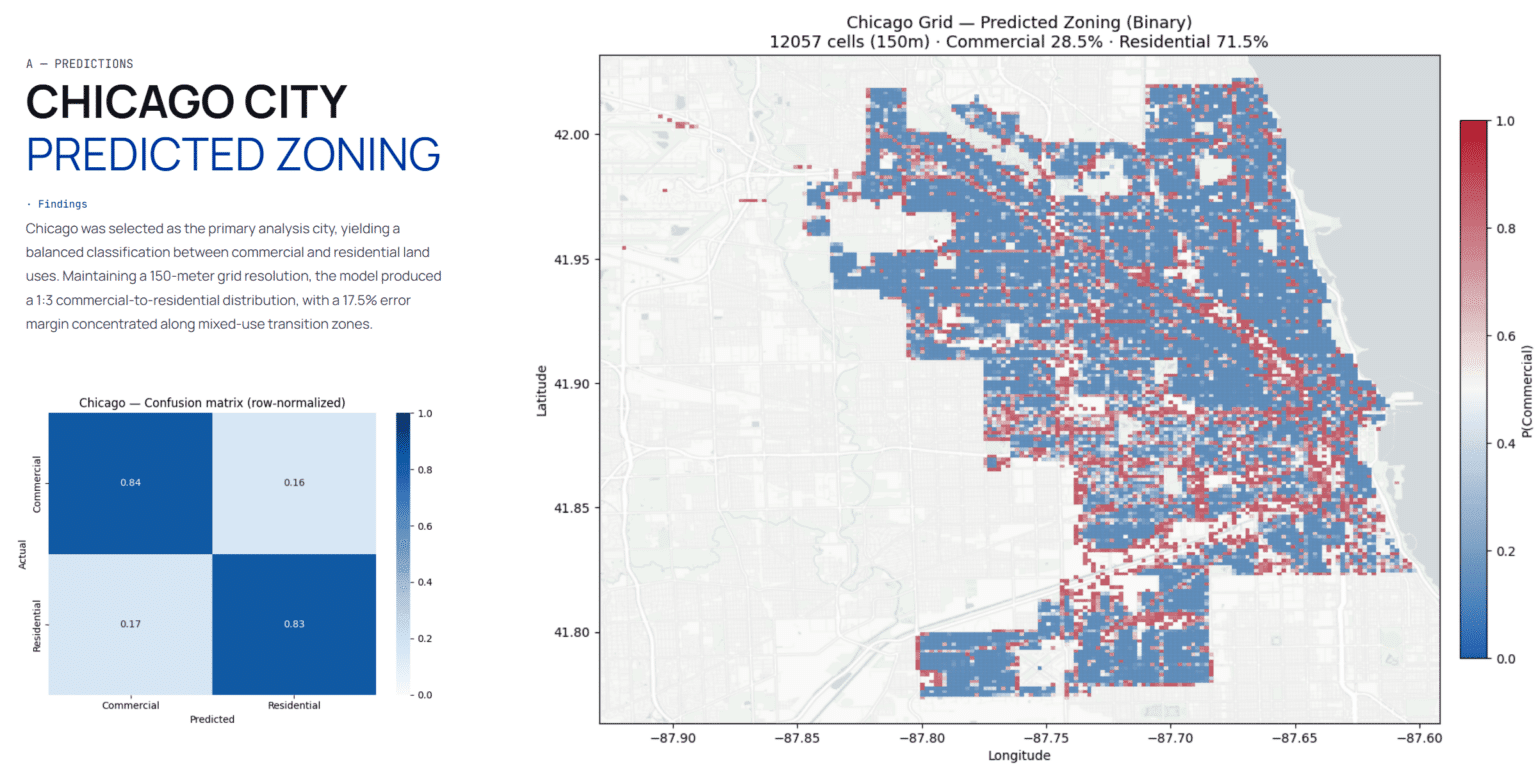
The useful result is not a single accuracy figure but a threshold: how much data, at what resolution, before prediction becomes trustworthy at city scale. Below it the model is confidently wrong, which is the failure mode that matters.

Classes
Commercial vs residential
Unit
Spatial grid cell
NYC · Urban Land Use — 14
NYC · Urban Land Use — 15
NYC · Urban Land Use — 16
NYC · Urban Land Use — 17
NYC · Urban Land Use — 18
NYC · Urban Land Use — 19
NYC · Urban Land Use — 20
NYC · Urban Land Use — 21